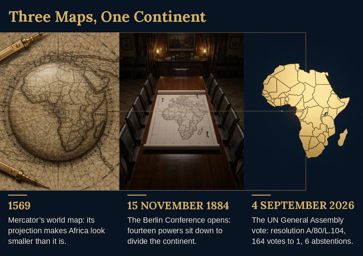
Three Maps, One Continent. Illustration, left to right.1569 – Mercator’s world map: its projection makes Africa look smaller than it is.15 November 1884 – The Berlin Conference opens: fourteen powers sit down to divide the continent.4 September 2026 – The UN General Assembly vote: resolution A/80/L.104 is adopted by 164 votes to 1, with 6 abstentions.
On 15 November 1884, fourteen governments sat down in Berlin to settle questions about a continent whose people were not in the room. They were Germany, France, Britain, Belgium, the Netherlands, Denmark, Sweden-Norway, Austria-Hungary, Italy, Russia, Spain, Turkey, Portugal and the United States. It is 142 years today.
In June I wrote about how that Conference ended: the rules it left behind, and the borders that followed from them. I said then that the familiar world map shrinks Africa, and that the map and the Conference only rhyme. Today I begin at the other end, with how Berlin started, why it took until February to sign, and what it did. Having looked again, I no longer think rhyme is the whole of it. I want to do more than retell the story. I want to ask what Berlin teaches, and what we do with it.
Where Berlin began
Nobody called the Conference to ask Africa what it wanted. The historian Arthur Berriedale Keith, writing in 1919, sets out the sequence plainly. Portugal claimed the mouth of the then Congo. Leopold II, King of the Belgians, headed a private body, the International Association of the Congo. It was building stations upriver, had won the recognition of the United States, and in April 1884 had promised France first refusal of its possessions. By June, Keith writes, it was clear that only an “international” conference could settle the matter. The formal proposal was credited to Portugal. Germany secured France’s assent by recognising, on 13 September, France’s right of pre-emption. And on 8 October, Germany and France together issued the invitations.
Read that again. As I read it, the question was never “who has the right to this land?” It was “how do we avoid fighting each other over it?” The powers named by Keith were Europe’s and the United States; Africa’s own peoples are not on his list. They were the subject of the agenda, not participants in it.
Why signing took until 26 February 1885
The Conference met on 15 November 1884, broke off over Christmas and the New Year, and concluded its work on 26 February 1885 with the signature of a General Act. Fourteen powers sent representatives, and Otto von Bismarck, Germany’s Chancellor, was President, though Keith notes he left the work to others. In the Preface to Adebajo’s The Curse of Berlin: Africa after the Cold War, Prof. Ali Mazrui says:
“It is one of the ironies of the great German Otto von Bismarck that he helped to unify Germany in the nineteenth century and initiated the division of Africa soon after.”
Why so long? Keith’s answer is specific. The territorial questions between France, Portugal and the Congo were not formally within the Conference’s scope, but a General Act was impossible until they were settled. Britain threw her influence into resolving the difficulties raised by Portugal, and Portugal was finally compelled to agree, which left the way open for the signature. Each of those bargains was a bargain over African territory, struck among the powers, and no African representative was present at the Conference.
What the Act did, and what followed
The General Act did not itself cut the continent into pieces. It did something quieter: it wrote the rules by which the powers would claim the coast. A power taking possession of a tract of coast had to notify the other signatories, and had to establish authority there sufficient to protect existing rights. A rule about how to claim is also a rule about who may claim, and the people already living on the land were not among those who could.
That is the difference between a map and a convention. A map shows. A convention decides.
Berlin is the sitting we can point to. There the powers wrote the rules for claiming a continent and settled the Congo among themselves. The lines themselves were drawn afterwards, treaty by treaty, among the same powers who had sat in that room.
The first test of that difference came in the Congo itself. The Act made two promises in its own words. No power exercising sovereignty there could grant a monopoly or favour of any kind in trade. And the powers bound themselves to watch over the preservation of the native peoples and to care for their moral and material well-being. Leopold’s Association, whose claim the powers had recognised in and around Berlin, broke the first promise by decree: in 1891 and 1892 the Free State reserved the land and its produce to itself. The second promise fared no better. Estimates of how many Congolese died under the regime run from 1.2 million to 10 million. There was no census until 1924, historians still argue over the figure, and disease was a main cause, worsened by the regime’s disruption. Even on the lowest count, the toll exceeds that of the Herero and Nama, the tens of thousands killed by Germany, the Conference’s host, in South West Africa between 1904 and 1908. That killing is recognised as genocide; the Congo’s is not generally called one.
I do not say Berlin caused what followed. The decrees came six years after the Act, and the promises were Berlin’s own. I say it can be argued that Berlin gave a private venture the standing of a state, wrote the promises, and, as I read the text, named no one to answer for them. Not an order, but a licence.
What Berlin left behind
The Scramble for Africa stands as the starkest test of the argument that “discovery” functions as a legal-technical instrument of possession rather than a description of fact, because Africa was never epistemically unknown to Europe. Centuries of trade, coastal contact, and accumulated knowledge meant that what “discovery” accomplished there was not revelation but conversion: knowledge into possession, prior habitation into “effective occupation,” and African agency into blank space.
The continent already contained great Kingdoms and dense trade networks across the Sahara and Indian Ocean, yet the politics of “discovery” framed it as empty space awaiting European inscription, and eventually, civilisation. The political work of “discovery” shifted from the epistemic (“we didn’t know it existed”) to the legal (“we now claim it”). This made the Scramble a re-description of a known land as available rather than a genuine encounter with the unknown.
The Berlin Conference gave the scramble its rules and its legitimacy among the powers, and its legacy remains a live battleground. As I see it, statues of Leopold II and Cecil Rhodes have been contested from Cape Town to Oxford, the Benin Bronzes looted in 1897 have become the paradigmatic case for repatriation, and the borders drawn after Berlin remain a source of contemporary conflict. I would add that counter-narratives, from Achebe’s Things Fall Apart to Rodney’s How Europe Underdeveloped Africa and Ethiopia’s victory at Adwa, shift agency back to Africans. The key formulation is that in the Americas, “discovery” erased presence; in Africa, it erased polities and converted them into real estate. Studying its politics means asking of Berlin, Stanley, and the Benin Bronzes what one asks of Columbus: who got to name the event, whose knowledge counted, and who benefited from the story being told one way rather than another.
The Berlin Conference, convened to set rules for European claims and trade in Africa, left behind a cartographic legacy that outlasted the empires that drew it. The borders were carved afterwards, treaty by treaty, with rulers and compasses, by the powers who had sat at Berlin, indifferent to the ethnic, linguistic, and political realities of the continent they dissected. Decades after the last European flag was lowered, most of those lines still stand, and with them, a set of structural vulnerabilities that continue to shape African politics.
Among the most enduring legacies of the Conference is the persistence of Africa as a subject for scramble. Where once European powers competed for territory, today the competition is economic and strategic: foreign powers, multinational corporations, and proxy networks vie for access to minerals, energy, arable land, and political influence. What distinguishes the present scramble from the nineteenth-century one is not its absence but its form, and, I fear, our own diminished will to resist it. The instruments of sovereignty exist – borders, constitutions, regional bodies – but the exercise of that sovereignty against outside pressure remains inconsistent and, in many cases, absent.
The lines the powers drew after Berlin also bequeathed to the continent a number of small states whose viability was never assured: states whose territory, resources or population leave them dependent on external patrons, exposed to external pressure, and often unable to project authority across their own nominal territory. Their borders have since been entrenched by the norms of the post-colonial international order, and the states most disadvantaged by the colonial map have the least interest in reopening it. The result is a frozen cartography: vulnerable entities preserved along lines Africa’s peoples did not choose.
The infrastructure legacy is equally telling. Where transport networks exist, many remain etched on the pit-to-pot model inherited from the colonial economy: railways and roads run from extraction sites – mines, plantations, oilfields – to ports for export, rather than connecting African markets to one another. The geometry is that of the drain, not the web. Goods move outward to the coast and onward to foreign consumers, and intra-African trade has been hobbled by the absence of corridors that would link producers to regional markets. The infrastructure, in other words, still serves the purpose for which it was built: to extract and export, not to integrate and develop.
Read together, these legacies describe a continent whose formal independence was not matched by structural independence. The scramble continues in new guises; the vulnerable small states endure along colonial lines; the roads and rails still run from pit to pot. The Berlin Conference is long over, but its grammar – of externally imposed design, extractive orientation, and fragmented polity – remains written into the continent’s political and economic landscape. Until African leadership treats that grammar as something to be rewritten rather than merely inhabited, the legacies will continue to compound.
The map, and the table
Here is where I part company with my own June sentence.
In 1569 Gerardus Mercator published a world map built for those who sail. It was made so that a navigator could hold a straight course. For that purpose it was a triumph. It also does something it was never asked to do: it swells the lands the further they lie from the equator. Africa sits on the equator.
Why was it drawn this way? For the sailor. And why did it stay as it was?
Here the record is plainer than I expected. Equal-area maps were not unknown. A cylindrical equal-area projection dates from 1772, and in 1855 James Gall presented another. By 1900, one history of the projection records, Mercator was well entrenched as a general-reference map even though academic cartographers argued it was ill suited to that purpose. In the 1970s the German Arno Peters made the political case outright: that Mercator favoured the colonial powers. Cartographers condemned his projection and his claims, and in 1989 and 1990 seven North American geographic organisations rejected rectangular world maps altogether, Mercator’s included.
So the picture was known to be ill suited, and yet it stayed. That is my reading: a failure of will more than of knowledge. Some of the resistance was fair, as I say below. But the pattern is the one I traced at Berlin. A map made for those who would travel across the world; a conference convened by those who intended to land. In both, the picture was settled by people it did not describe.
Chinua Achebe, in a 1994 interview with The Paris Review, reached for what he called “that great proverb”:
“until the lions have their own historians, the history of the hunt will always glorify the hunter.”
A people who inherit someone else’s picture of themselves inherit someone else’s account of who they are.
What the United Nations has now said
On 4 September 2026 the General Assembly adopted a resolution known as “Correct the Map.” One hundred and sixty-four member states voted in favour. One voted against: the United States. Six abstained: Estonia, Georgia, Lithuania, Moldova, Serbia and Ukraine.
It did not begin in New York. It began with two African organisations, Africa No Filter and Speak Up Africa, who asked whether something the world had accepted for generations could be changed. The African Union took the campaign up in August 2025, and Togo put the resolution to the Assembly on behalf of the African Group. An idea from civil society became a continental position, and then a vote. It is worth knowing who carried it.
I want to be careful about what that vote is. It is the largest body of states on earth saying, in effect, that the picture Africa has been handed is wrong. That matters. The picture was known to be ill suited long before, as I have set out above. What is new is who has said so, and how many.
A corrected map does one thing: it shows Africa’s size in true proportion to the rest of the world, as it actually is. It does not redraw a single border, and it does not ease the vulnerability of the continent’s smallest states. Only imagination can show us how African states might have looked had they been allowed to evolve on their own. Whether those lines should ever be redrawn, I dare say, is a question for generations to come. Ours is the nearer task: to refuse to be divided by them.
What the Assembly’s record shows is who voted, and how. A resolution is a statement of principle. It is not a remedy. So the question is what Berlin teaches us to do with it.
What Berlin teaches
Three things, as I read it.
First, power sits in the rules before it sits in the land. But the rules themselves are set by the powerful, acting in their own self-interest. The General Act did not itself cut the continent. It wrote the rule for claiming the coast, and the interior followed in bargains among the same powers. Whoever writes the terms of a claim holds the advantage before the first claim is made. And no African wrote them.
Second, the powers settled their quarrels with one another and called it order. As Keith tells it, the question was how to keep the claimants from fighting each other over the Congo, and each bargain on the way to the Act was a bargain over African territory. Peace among the signatories was arranged with something that belonged to someone else.
Third, what is settled by default stays settled until someone pays the cost of challenging it. Mercator’s map was a good map for sailors that became the world’s map by default. The alternatives were on the table for more than a century and a half. Some of the resistance to them was fair: an equal-area map distorts shapes, and Peters did not credit Gall. But a fair objection to one map was never a reason to leave the other as the default for half a century. It took African organisations, African governments and a vote to make the challenge worth the cost.
What we do with it
The resolution is the first lesson turned back on itself. For once, the rule about how the world pictures Africa was put to the world by Africa’s own states. But it encourages. It does not compel. It reaches a child only when someone who controls the wall, the textbook or the screen chooses to act.
In my view, the Berlin Conference was a wicked act of imperialist greed, which wrote the rules of the scramble. In the same Preface, Mazrui says:
“Africa, since its partition, has seen its mineral wealth exploited for the benefit of others, its fertile land left uncultivated, its rich cultures destroyed, and its brain-power ‘drained’ to other parts of the world. At the centre of this calamity is the role of the West in creating an international system that has reduced proud Africans to the lowest caste of the twentieth century. How will post-colonial Africans overcome this condition in the twenty-first century?”
Needless to say, Mazrui summons the agency of post-colonial Africans consciously to do something about these calamitous effects of the Berlin Conference.
The campaign that carried the resolution has named where the work now lies: the United Nations’ own publications; ministries of education; newsrooms and publishers; the technology companies whose screens most people now look at; and a public record of who adopts and who does not. That is a sound list. Here is what I would ask of us.
Of institutions: adopt, and say so in public. A quiet change helps no one learn who followed.
Of ourselves: look at the map on the nearest wall, in the school, the newsroom, the office, and ask who chose it.
Of the record: keep it. A commitment that nobody tracks is a sentiment.
Berlin shows what happens when the rules are written without you. The answer is not outrage. It is to be in the room when the next rule is written, and to read it before it is signed.
In 1884, fourteen governments wrote the rules for claiming a continent, and no African was in the room. In 2026, one hundred and sixty-four states have said that the picture of that continent is wrong. Between those two sentences lie 142 years, and a vote does not close them. We close them by being present, and by reading what is signed. Noticing is where the work starts. It is not where the work ends.
“The future is not an accident.”
Dr Malusi Gigaba is a Scholar-Statesman, an ANC NEC Member, a former Cabinet Minister of the Republic of South Africa, a Member of Parliament, and a member of both the Portfolio Committee on Trade, Industry and Competition and the Portfolio Committee on Justice and Constitutional Development.